- Floating Structures
- Raising building elevation (stilts)
- Reservoirs
- Sewage treatment
- Prioritize services/ building types to fortify
- Prototype Housing
Monday, January 11, 2016
CONSIDERATIONS
CONSIDERATIONS

Information on Bangladesh History
Located Northern Coast of Bay of Bengal. Surrounded by India, Capital: Dhaka.
Low-lying riverline (situated on a river) Due to tropical monsoons climate (June to Sept) they experience heavy rain and floods.
They gained independence from Pakistan in 1971
Population: 166280712 approx
And it's capital Dhaka with a population of 15.391 million
Official language is Bangla
Literary rate of 57%
Currency: taka
Religion- 89% Muslim, 9.6% Hindu, .9% other
Econ- Unemployment rate 5%
Industries- cotton textiles, tea processing, garments, jute (golden fiber plant)
Agriculture- rice, tea, jute, wheat beef
Exports: garments, leather, seafood, frozen foods, jute and goods
Transportation: 95% of highways are unpaved
Waterways 8370 km (3060 km are main cargo routes)
Labor- 78 million exported to other surrounding countries 47% agriculture, 13% industry, 40% services
GDP: 1800 per person annually/
Sunday, January 10, 2016
Preventive Structures
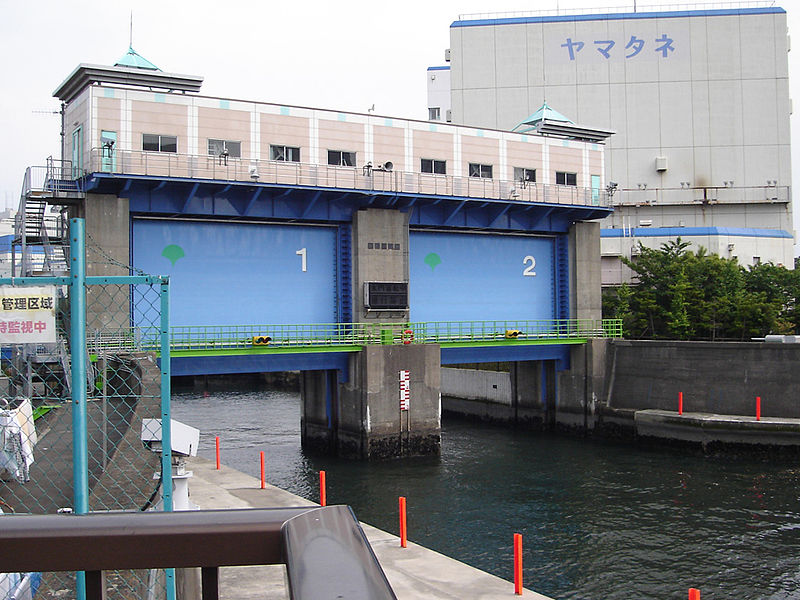 |
| Flood-gates, an adjustable gate that can monitor the flow of water of a river, reservoir, or stream |
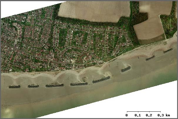 |
| Breakwater Structure-are situated some distance away from the shoreline, to lessen the force of waves. |
 |
| Seawall- which has a re curved crest wall that helps to repel incoming waves/water. Serves the dual purpose of creating an area for people to congregate and have an overview of the shoreline. |
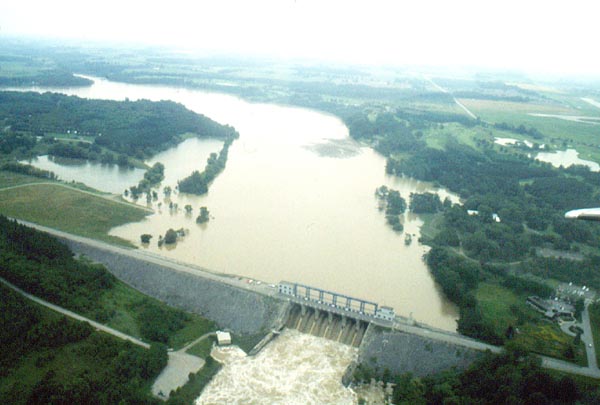 |
| - Traditional dams, that will help control flooding. |
Monday, January 4, 2016
Dhaka Land Use (Notes)
Land Use
Meghna River
Population of 11 million below poverty line (16%)
Unemployment 19%
Dhaka has the largest economy in Bangladesh
Average Annual Income $4,822
Nestle
GSK- drug comp.
HSBC bank
British American Tobacco Company
International trade, textiles, pharmachemical + financial
Exports
$10 billion
Food Industry
Ganges Delta
75% of Bangladesh is less than 10 meters above sea level
Reinforced Concrete walls is an option
Other Factors that contribute to flood:
-Monsoon Season during summer
-Himalayas Melting
5,000 people killed
7 million homes destroyed
Small Floods sustain agricultural industry
Flash flood
monsoon
Normal--> Meghna, Ganges
Rain Fed
13.1 million people in 1,300 km^2
Buriganga River--> South
Balu + Shitalaklaya--> East
Tongi Canal--> North
Turag River--> West
20 Km^2 of land are 8 meters
75 Km^2 between 6-8 meters
170 Km^2 below 6 meters
3.1 million live in slums--> on private land 70%
^ --> on government land 26%
(37%)
Building Types:
Multi story- brick & tin
Single Story- tin & Kutcha (brick, clay, and bamboo)
Interesting article Team 4
http://mobile.nytimes.com/2014/03/29/world/asia/facing-rising-seas-bangladesh-confronts-the-consequences-of-climate-change.html?referer=
Subscribe to:
Posts (Atom)